June 28, 2020
By: Staff Report
TAMPA Fla. – In whats being called the most significant dust cloud in 50 years, has now cloaked the U.S. Gulf Coast in a thick, dusty haze.
The dust cloud, which originated in the Sahara desert and drifted across the Atlantic, is forecast to continue moving north and east throughout the weekend, impacting areas from Texas and Florida, and will move as far north as Canada.
Most of the dust layer exists far above the surface, between a few thousand feet above the surface to about 15,000 to 20,000 feet above. However, mixing of the atmosphere and rainfall can bring that dust to the ground, and that’s when it can become harmful to people with respiratory issues.
In areas of Iraq and Kuwait, where dust clouds and storms are prevalent, there is the high content of fine particles that are associated or suspected to be associated with respiratory diseases, such as desert lung syndrome and severe acute pneumonitis.
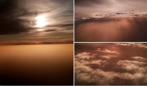
The Saharan dust cloud is said to give the gulf coast some amazing sunsets and sunrises.
Saturday night, Christy Shields tweeted from a flight out of Clearwater, with some beautiful pictures.
SAHARAN DUST from an airplane view! How cool are these photos that Kelsey sent in from her flight from Clearwater, FL to State College, PA! pic.twitter.com/W3VGHEDSza
— Christy Shields (@WxShield) June 27, 2020
The dust is also expected to cut down on the risk of hurricanes because of the dry air accompanying it.


