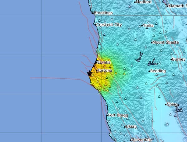
California Geological Survey Impacted Area Map A magnitude 6.4 earthquake rocked Northern California early Tuesday morning, the strongest earthqua
A magnitude 6.4 earthquake rocked Northern California early Tuesday morning, the strongest earthquake the area has seen in years, according to the California Geological Survey.
The California Geological Survey said the earthquake struck at 2:34 a.m. PT in Pacific Ocean waters about 7.5 miles west of Ferndale at a depth of just over 16 miles.
The city is about 19 miles south of Eureka near the California and Oregon state line.
Android Users, Click Here To Download The Free Press App And Never Miss A Story. Follow Us On Facebook Here Or Twitter Here. Signup for our free newsletter by clicking here.
As of early Tuesday morning, the National Weather Service’s tsunami warning system reported there was no tsunami threat associated with the quake.
“This is a Humboldt Alert. Due to a large earthquake, widespread damages to roads and homes are reported throughout Humboldt County. Be prepared for aftershocks. Check gas and water lines for damages or leaks. Exercise caution if traveling. To report a gas leak or inquire about power restoration, contact P G & E at: 1-800-743-5000 Check with your local water district for any water-related questions,” said Humbolt County Sheriff’s Office.
“A M6.4 earthquake has occurred south of Eureka, CA in northern CA (Humboldt Co). Additional shaking from aftershocks is expected in the region. We are continuing to monitor this event,” said California Geological Survey.
Just before 4 a.m. PT Pacific Gas & Electric Co. reported tens of thousands of customers without power in the area.
In Humboldt County alone, where Ferndale is located, more than 70,000 people were in the dark.

