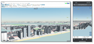
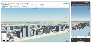
3D on PC and smartphone 3D Maps provide an understandable visualization of the tactical situation and the overall COP. The more data we have in the C
3D Maps provide an understandable visualization of the tactical situation and the overall COP.
JUPITER, FL, US, September 15, 2023/EINPresswire.com/ — AGIS C5ISR now provides optional 3D mapping capabilities providing the warfighter with visual terrain and structure elevation data in the Common Operational Picture (COP).
The AGIS C5ISR system provides operators with an advanced photorealistic view of the battlespace anywhere in the world. The mapped display can show a worldwide view or a zoomed in location down to 50 feet along with the precise location of users, ships, aircraft, military marker symbols and more with detailed readouts of each symbol including lat/long, heading, speed, range and bearing where available. All of this is now available in an 3D map display.
When selected, the AGIS 3D maps show the terrain landscape at the appropriate elevation and viewing angle along with streets, buildings, structures, and mountainous terrain. Aircraft and ships along with troop locations are also represented in the 3D map and updated as the satellite and terrestrial information is received from Link 16, JVMF, OTH Gold, CoT and NATO data links. The 3D representation of the Area of Operations enables a more accurate visualizations of spatial relationships of the sensor and data link data.
In addition to the data link and sensor data, the system incorporates MIL STD 2525 symbology and the ability to attach text, photos, videos, and documents to these symbols. Current AGIS C5ISR features including Tactical Graphics, Whiteboards, Keep-Out-Zones, Line-of-Sight analysis. Radar Coverage diagrams and Satellite imagery will be incorporated into the 3D display in coming versions. The more relevant data one has in the Common Operational Picture the better. New 3D mapping gives valuable structural and terrain information for better visualization, for better and more strategic decisions.
This on-demand and fully functional AGIS C5ISR system includes video training for each function. It is available in language versions for English, Spanish, Ukrainian and Portuguese and can be easily translated to other languages.
This worldwide 3D capability provides better realism to Military Operations and assists the user in making more informed decisions.
Malcolm K. Beyer, Jr.
Advanced Ground Information Systems (AGIS), Inc.
+1 561-744-3213
beyerm@agisinc.com
![]()

