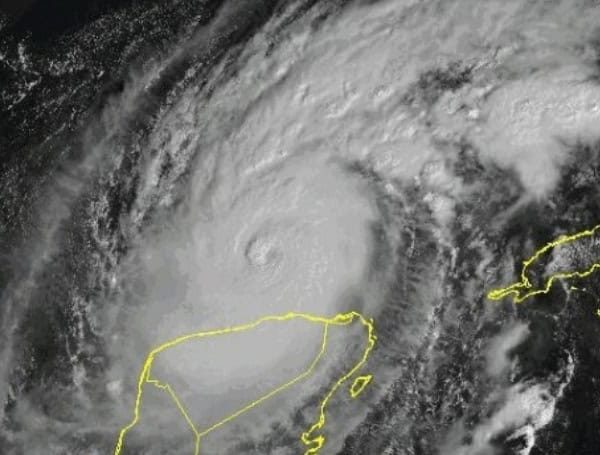
Hurricane Milton, a major hurricane currently swirling in the Gulf of Mexico, has undergone some internal changes but remains an extremely dangerous threat to Florida’s west coast. The storm is expected to make landfall Wednesday night, bringing with it the potential for devastating winds, a life-threatening storm surge, and heavy rainfall.
Overnight, Milton went through an eyewall replacement cycle, a process where the hurricane’s core reorganizes. While this sometimes weakens a storm, Milton appears to have maintained its intensity and may even have become more organized. Hurricane Hunter aircraft have measured winds of 156 knots (180 mph) in the eyewall, confirming Milton’s strength. The central pressure is estimated at 929 MB.
Milton is currently moving east-northeast at 8 knots. It is forecast to turn more to the northeast and accelerate today, putting it on a collision course with Florida’s west-central coast. While landfall is expected Wednesday night, the precise location remains uncertain. Even at this relatively short time frame, the hurricane’s track could shift.
READ: Hurricane Milton Evacuation Underway In Florida: Heavy Traffic, Bridge Closures Expected
A significant storm surge of 10 feet or greater is anticipated along portions of the west-central Florida coast. This poses an extreme threat to life and property. Devastating hurricane-force winds are expected near and to the right of where the center makes landfall. These winds will extend well inland, potentially causing widespread power outages and damage. Torrential rainfall is forecast across the Florida Peninsula, leading to potential flash flooding, urban flooding, and river flooding.
This is a life-threatening situation. Residents in west-central Florida should take this storm extremely seriously and follow the guidance of local officials. Evacuate if ordered and do not delay. Prepare for power outages and secure your property. Stay informed and monitor the latest forecasts and updates from the National Hurricane Center and your local news sources. Hurricane Milton has the potential to be a historic and devastating storm for Florida.
Key Findings from Hurricane Hunters:
- Eyewall Replacement: Milton completed an eyewall replacement cycle, a process where the hurricane’s inner core reorganizes. While this can sometimes weaken a storm, Milton appears to have maintained its strength.
- Intensity: A dropsonde released by a NOAA Hurricane Hunter aircraft measured an average wind speed of 156 knots (180 mph) in the eyewall, confirming Milton’s continued intensity as a major hurricane. The central pressure is estimated at 929 mb.
- Track: Milton is currently moving east-northeast at 8 knots. It is forecast to turn northeastward and accelerate later today, putting it on a collision course with Florida’s west-central coast.
READ: VIDEO: NOAA Aircraft Operations Rough Flight Through Hurricane Milton As It Eyes Florida
Landfall Expected Wednesday Night:
Landfall is expected sometime Wednesday night along Florida’s west-central coast. However, the National Hurricane Center (NHC) emphasizes that the exact location remains uncertain and could shift by 60-70 nautical miles.
Significant Impacts Expected:
- Destructive Storm Surge: A life-threatening storm surge of 10 feet or greater is possible along portions of the coast.
- Hurricane-Force Winds: Devastating hurricane-force winds are expected near and to the right of where the center makes landfall, extending well inland.
- Heavy Rainfall: Torrential rainfall is forecast across the Florida Peninsula, leading to potential flooding.
Urgent Call for Preparedness:
The NHC stresses that this is a very serious situation. Residents in the potentially affected areas are urged to closely monitor the storm and follow the guidance of local officials. Evacuations and other preparations should be completed today.
Hurricane Milton has the potential to be a historic and devastating storm for west-central Florida. Residents must take all necessary precautions to protect themselves and their families.
Please make a small donation to the Tampa Free Press to help sustain independent journalism. Your contribution enables us to continue delivering high-quality, local, and national news coverage.
Android Users: Download our free app to stay up-to-date on the latest news.
Connect with us: Follow the Tampa Free Press on Facebook and Twitter for breaking news and updates.
Sign up: Subscribe to our free newsletter for a curated selection of top stories delivered straight to your inbox.


