MOBILE, AL. - Our friends in the Northern Gulf Coast, from Florida to Louisiana, are in the path of Tropical Storm Zeta, and expected to become a hur
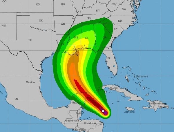
MOBILE, AL. – Our friends in the Northern Gulf Coast, from Florida to Louisiana, are in the path of Tropical Storm Zeta, and expected to become a hurricane at some point on Monday.
At 8:00 PM Sunday, the center of Tropical Storm Zeta was located near latitude 18.0 North, longitude 83.6 West. Zeta has been meandering recently, but a northwestward motion is expected over the next couple of days, followed by a turn to the north. On the forecast track, the center of Zeta will move near or over the northern Yucatan Peninsula or the Yucatan Channel late Monday, move over the southern Gulf of Mexico on Tuesday, and approach the northern Gulf Coast on Wednesday.

Maximum sustained winds are near 50 mph (85 km/h) with higher gusts. Strengthening is forecast during the next couple of days, and Zeta is expected to become a hurricane before it moves near or over the Yucatan Peninsula late Monday.
Tropical-storm-force winds extend outward up to 115 miles (185 km) from the center.
The minimum central pressure based on data from the NOAA Hurricane Hunter aircraft is 997 mb (29.44 inches).

COMMENTS