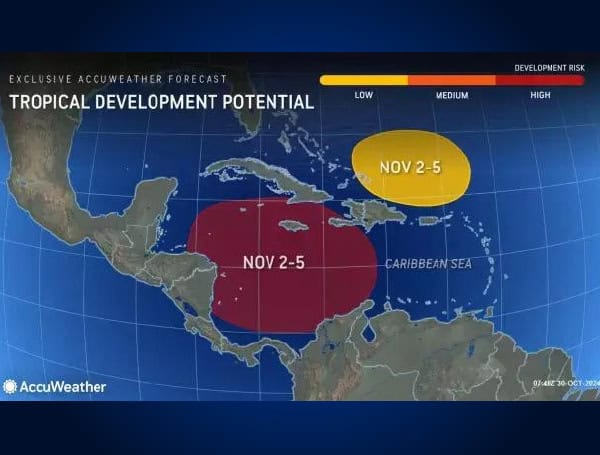
Although the Atlantic has been quiet since Hurricane Oscar moved through the northern Caribbean, AccuWeather meteorologists anticipate a reactivation of tropical activity next week.
Tropical development in the Caribbean Sea has progressed slowly this week, AccuWeather Lead Hurricane Expert Alex DaSilva noted. “We still expect tropical development in this area as we move into November.”
Despite favorable conditions like abundant moisture and above-average ocean temperatures, no named storms have formed recently due to high wind shear, which has hindered storm organization. “Wind shear has created a hostile environment for thunderstorms and showers, preventing them from consolidating into a tropical threat,” explained DaSilva.
READ: Liberty Mutual Eyes Hurricane Losses Near $900 Million In Florida, Georgia, And North Carolina
However, conditions are expected to improve as November begins. “Next week, most of the wind shear will shift northward, creating a pocket of high ocean temperatures, ample moisture, and low wind shear, which is favorable for tropical development,” DaSilva added.
AccuWeather estimates a near 90% chance of development in the Caribbean, while the National Hurricane Center has maintained a 40% chance. Regardless of tropical formation, rough surf and downpours are anticipated across the Caribbean through next week.
Meteorologists see two potential paths for any tropical system that forms: one heading toward Central America and another near the Yucatan Peninsula, with a northern route potentially impacting the eastern Gulf Coast around November 6-11.
READ: Florida Hurricane Recovery: UF Expert Urges Septic System Inspections
A high-pressure area forecasted to develop along the U.S. East Coast could initially steer any system westward, though its strength will determine if it continues west into Central America or turns northward into the Gulf of Mexico.
AccuWeather recently forecasted one to three additional named storms for the season. Florida and the Southeast coast face an elevated risk for tropical impacts, while the Gulf states from Texas to Alabama are at lower risk. The next name on the 2024 Atlantic hurricane list is Patty.
Please make a small donation to the Tampa Free Press to help sustain independent journalism. Your contribution enables us to continue delivering high-quality, local, and national news coverage.
Android Users: Download our free app to stay up-to-date on the latest news.
Connect with us: Follow the Tampa Free Press on Facebook and Twitter for breaking news and updates.
Sign up: Subscribe to our free newsletter for a curated selection of top stories delivered straight to your inbox.


